|
|
|
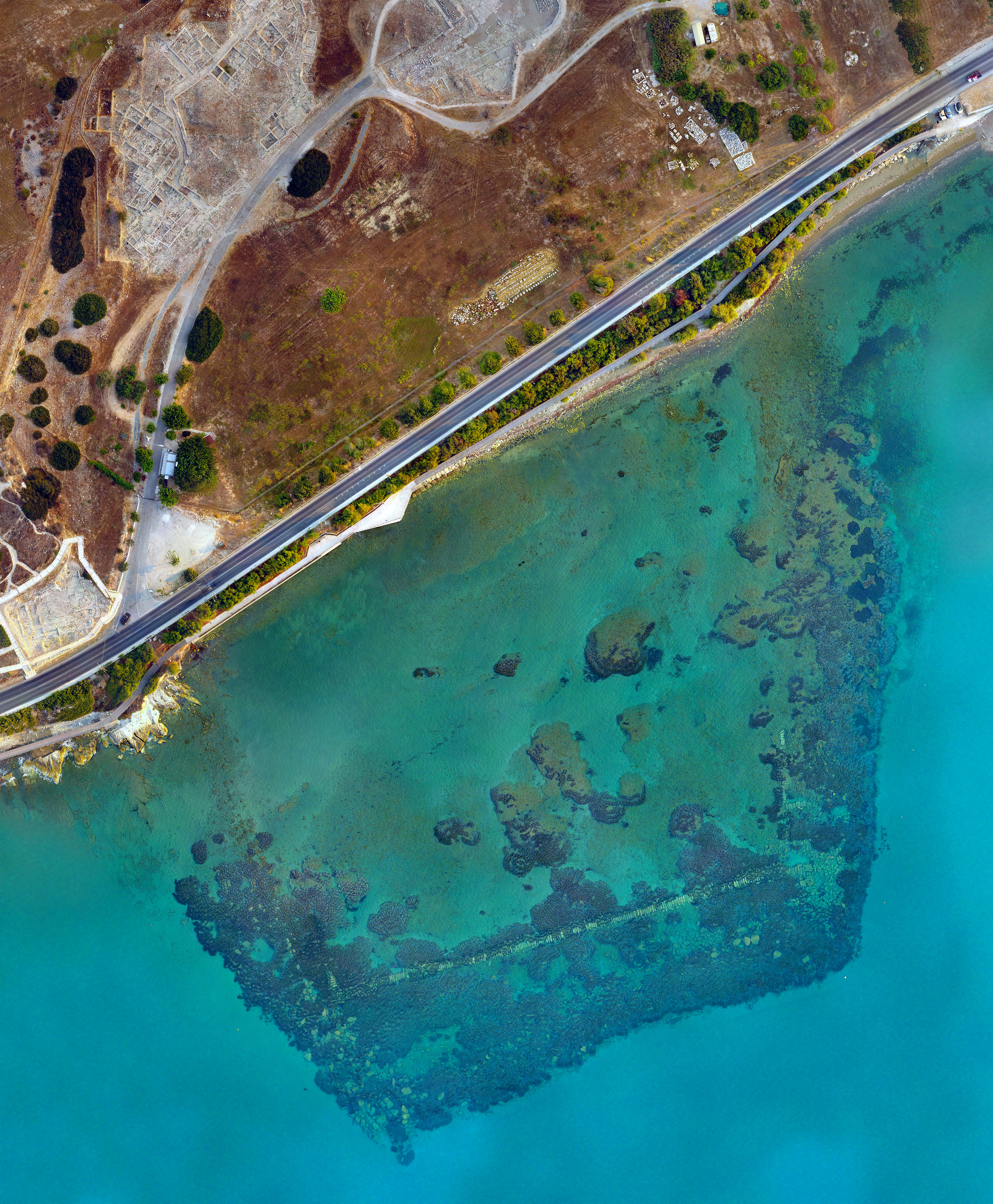
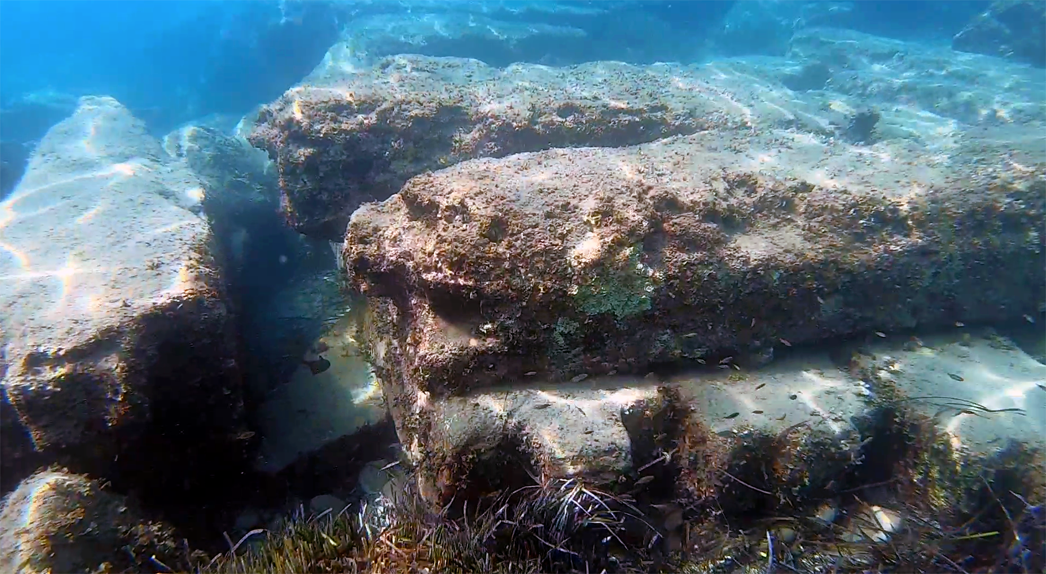
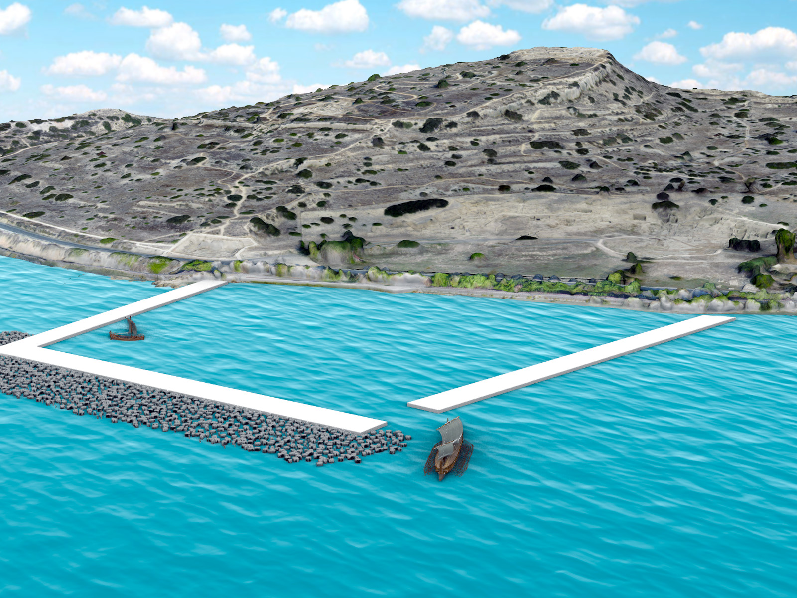
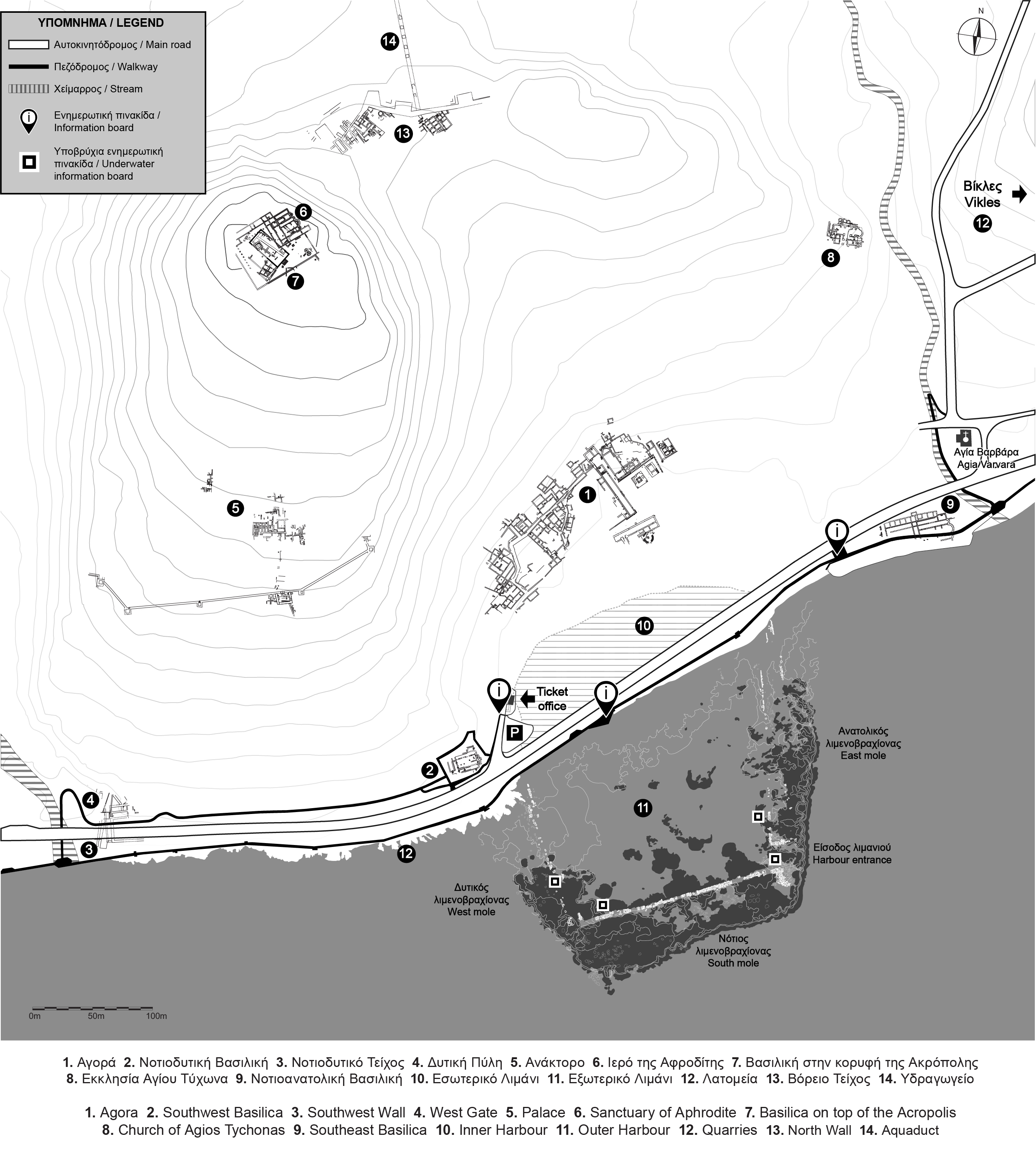
The MAritime ARchaeological REsearch Laboratory (MARELab), University of Cyprus, the Department of Antiquities of Cyprus and the Department of Fisheries and Marine Research of Cyprus, have undertaken a project for the promotion of the ancient harbour and the Marine Protected Area of Amathus, in the framework of the European Regional Development Fund programme ANDIKAT (Diving Routes in Marine Protected Areas of the Eastern Mediterranean - Development of Diving Tourism Network). The programme, which is co-funded by the European Union and national resources from Greece and Cyprus (Interreg VA Greece – Cyprus Program “2014-2020”), aims at developing a network of dive trails in coastal areas of Greece and Cyprus, as a tool to protect the marine environment, and raise public awareness for the preservation of the natural and cultural heritage. The abandonment of the harbour during antiquity created an unusual condition at Amathus: the site is preserved in its original phase without any disturbance from later use, as is often the case with other ancient harbour sites in Cyprus and the rest of the Mediterranean. The date and archaeological value of the harbour have already been well established, during the excavation that took place in the 1980s by the French Archaeological School at Athens, under the direction of Jean-Yves Empereur. Moreover, the preserved architectural remains are situated in shallow waters (up to -4m), close to the shore, allowing for easy access to the public. All these features, along with the unique biodiversity of the site, played a key role for including the harbour in the Marine Protected Area of Amathus, and thus for creating the first underwater archaeological park in Cyprus.
|
  |
|
       |
||
| . | ||
|
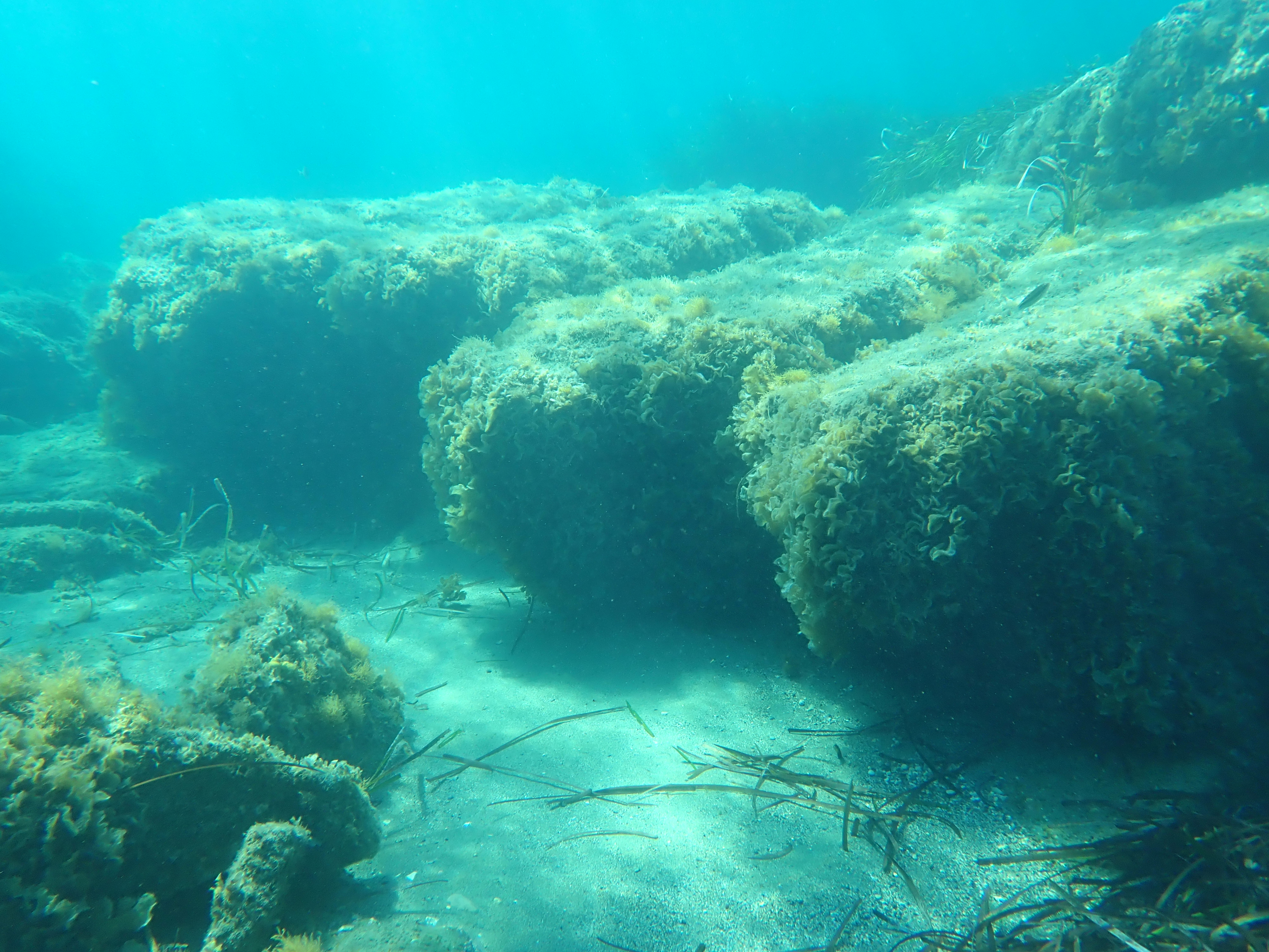
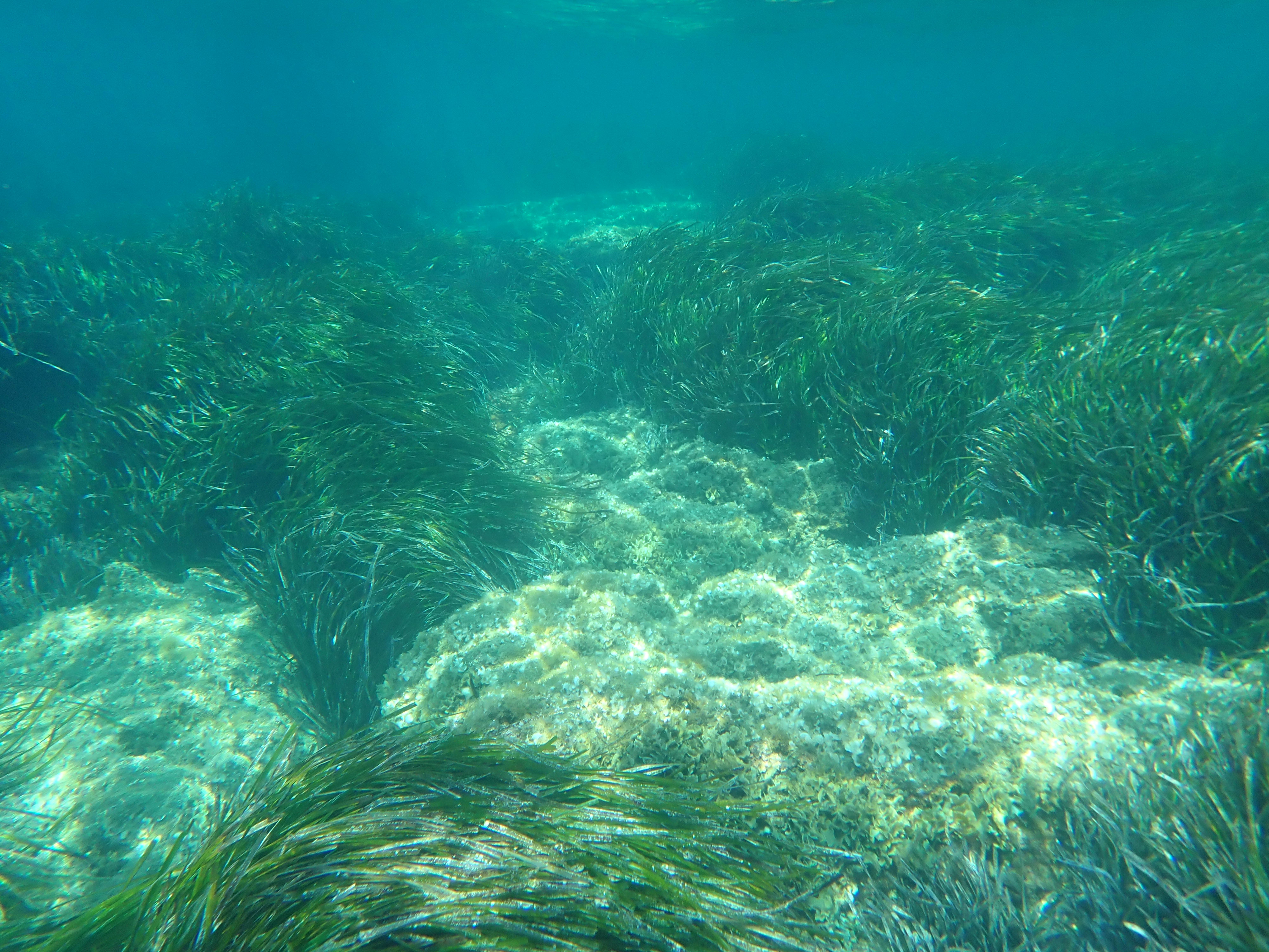
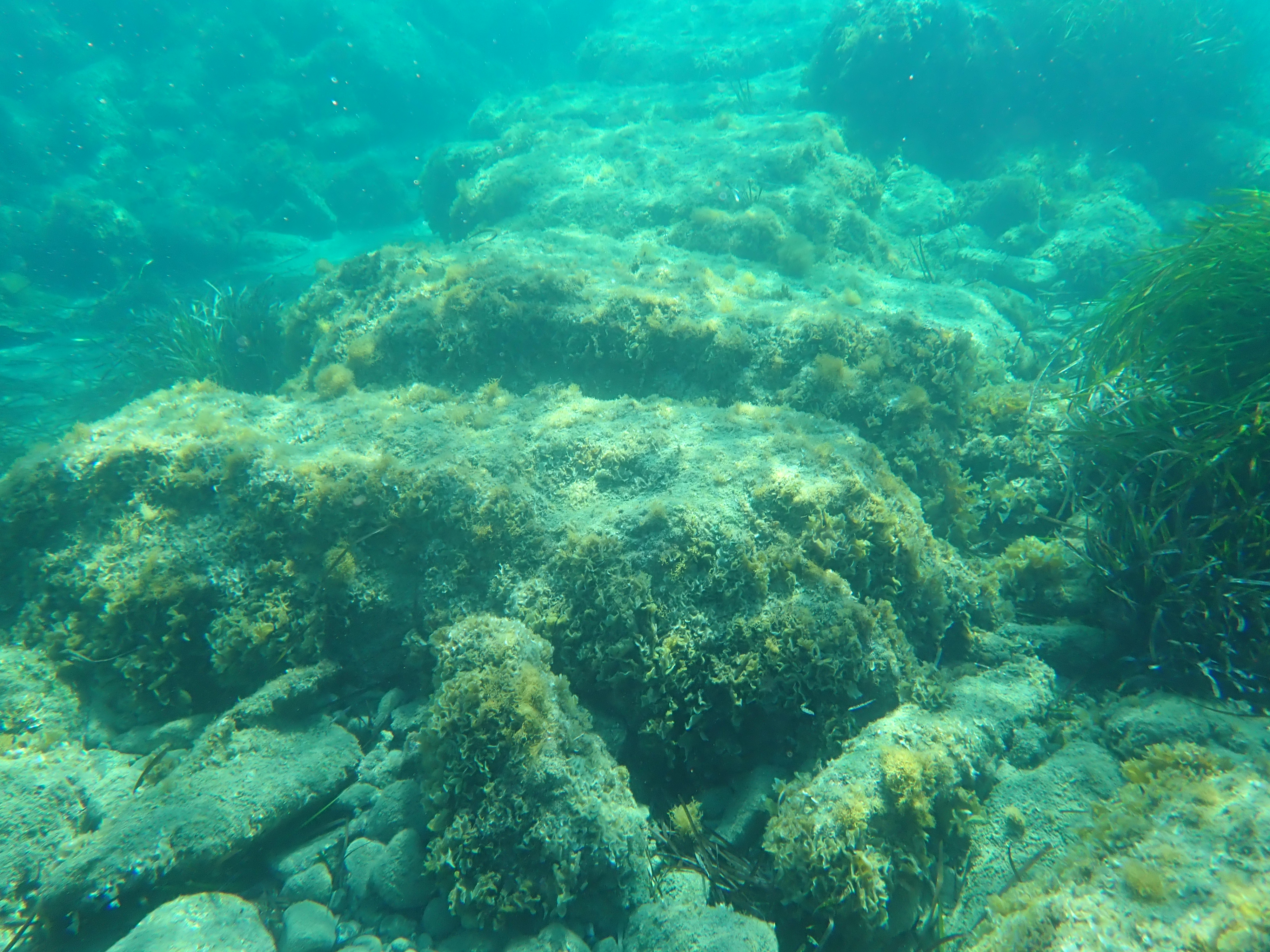
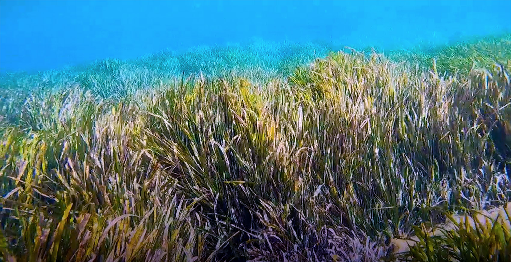
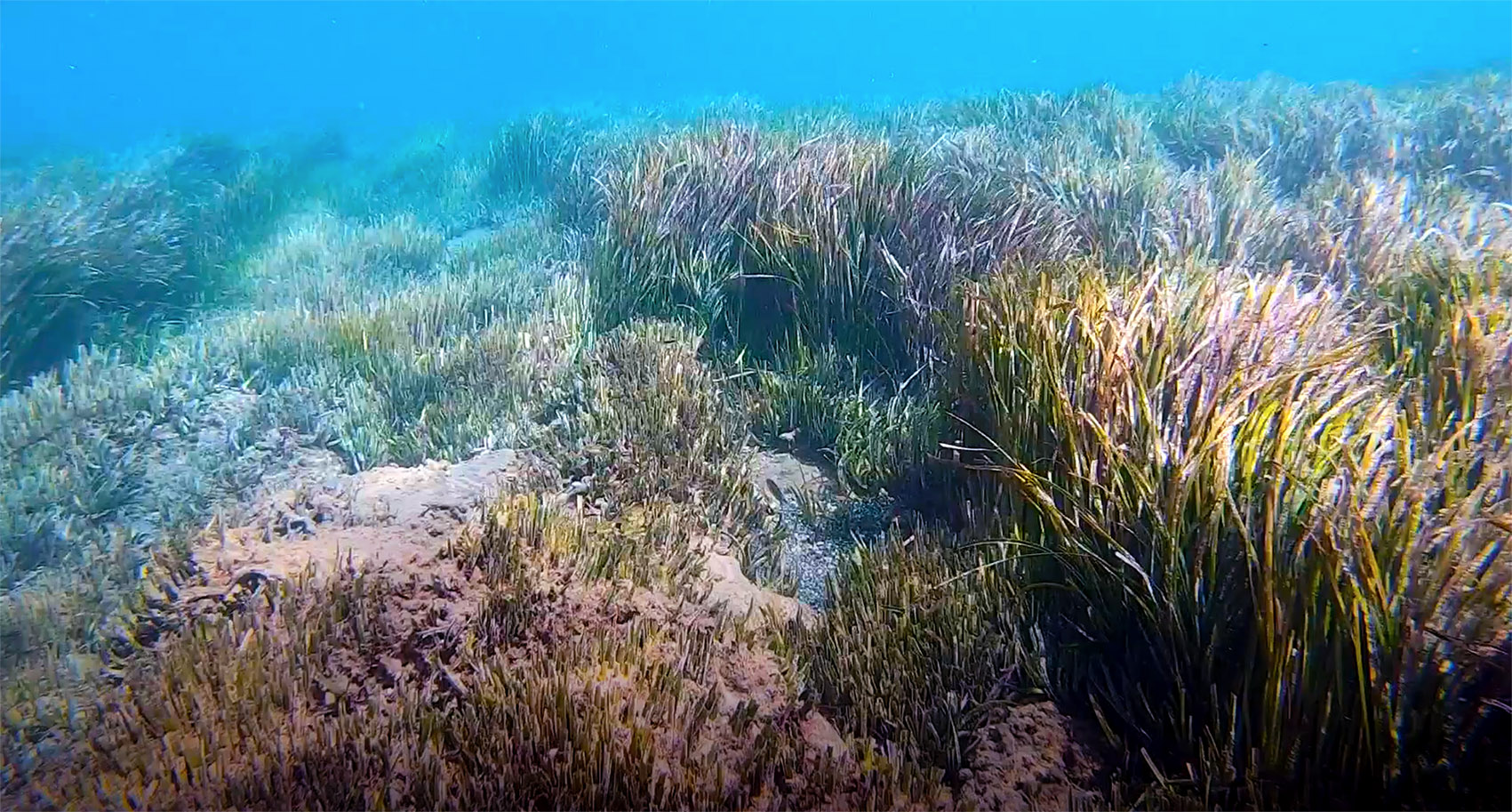
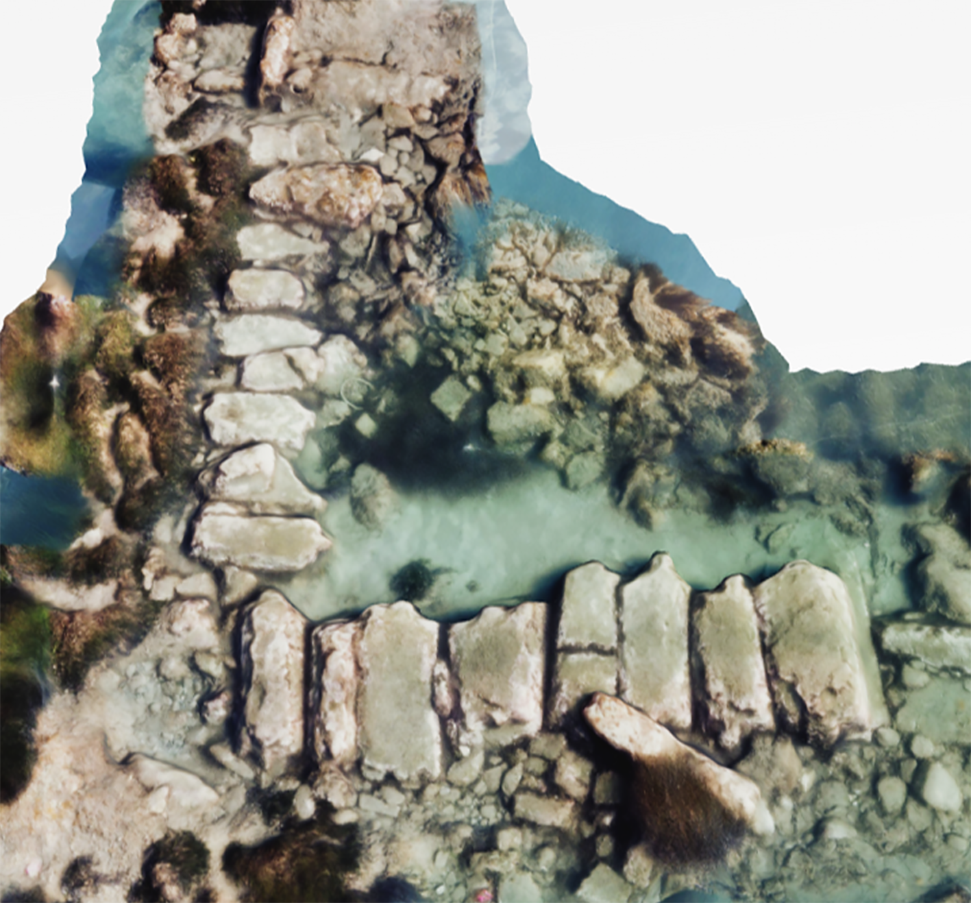
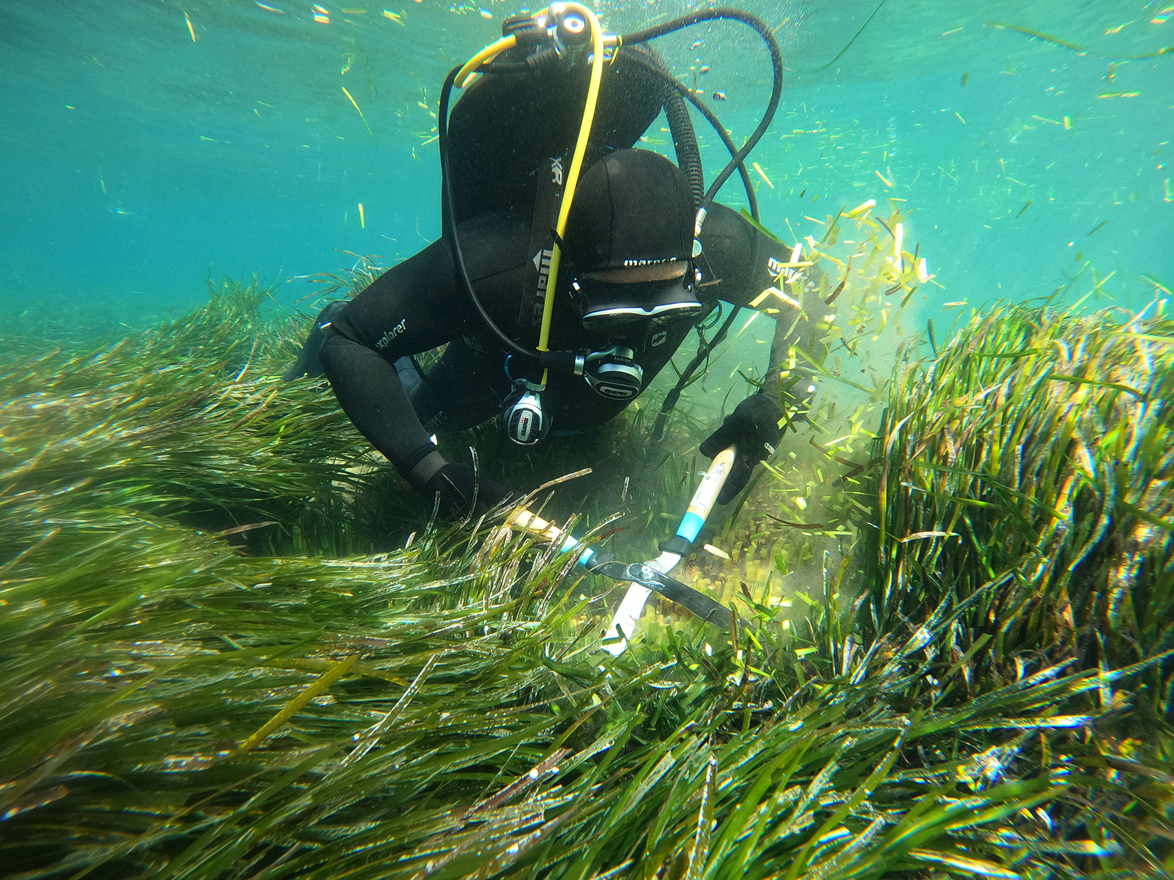
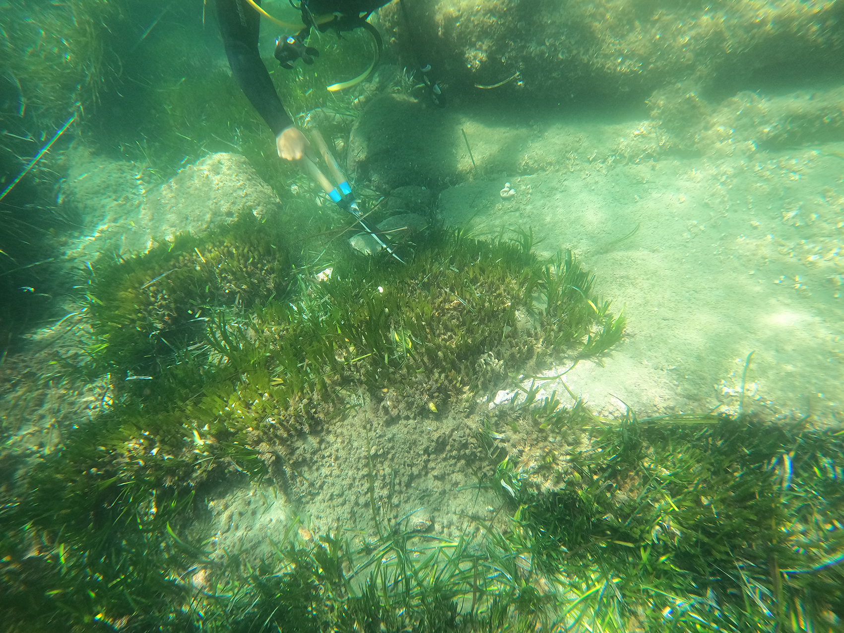
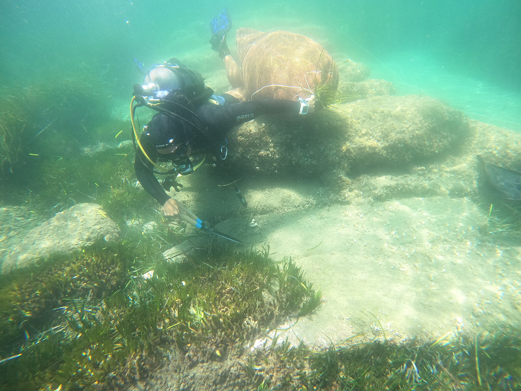
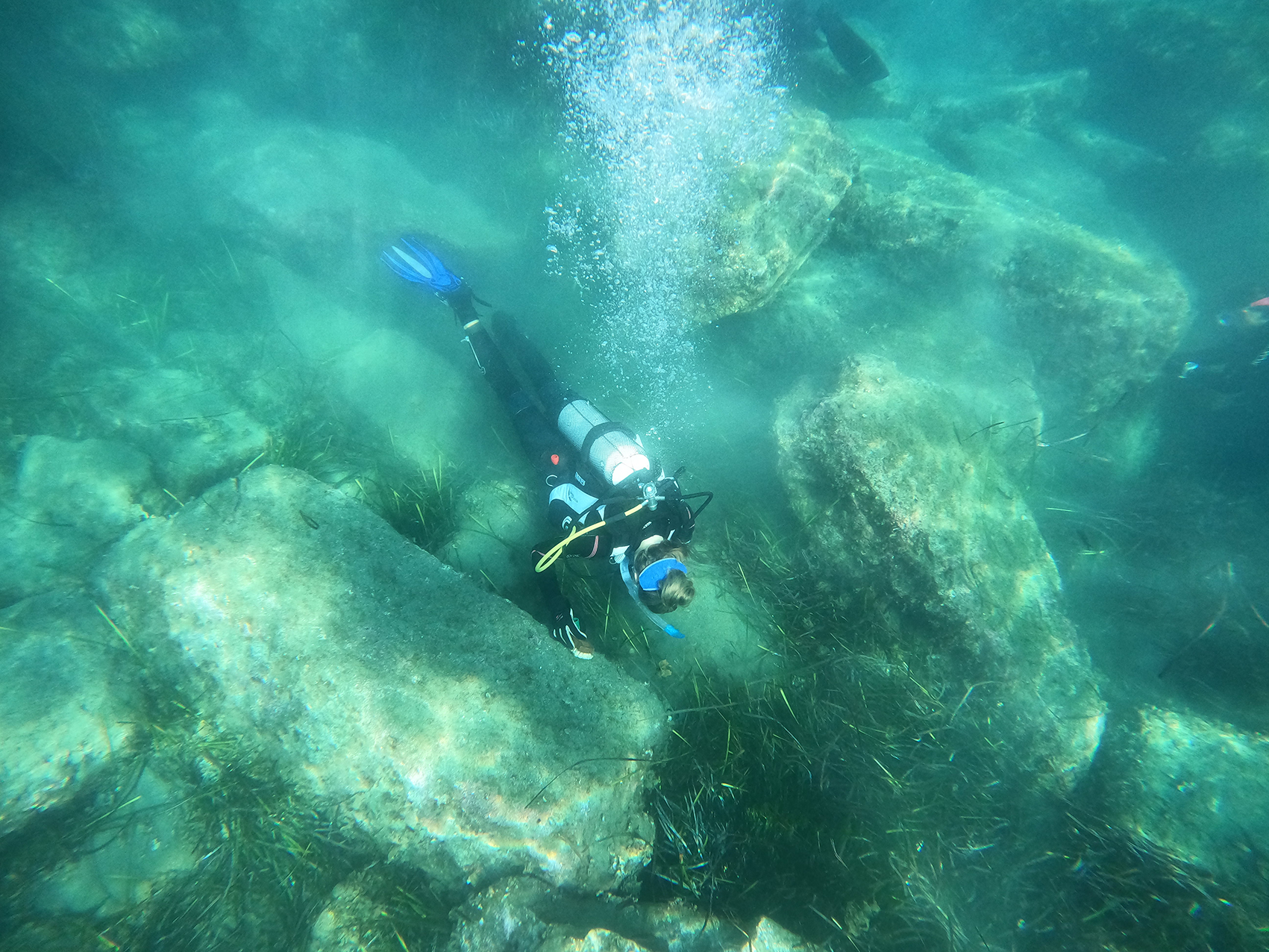
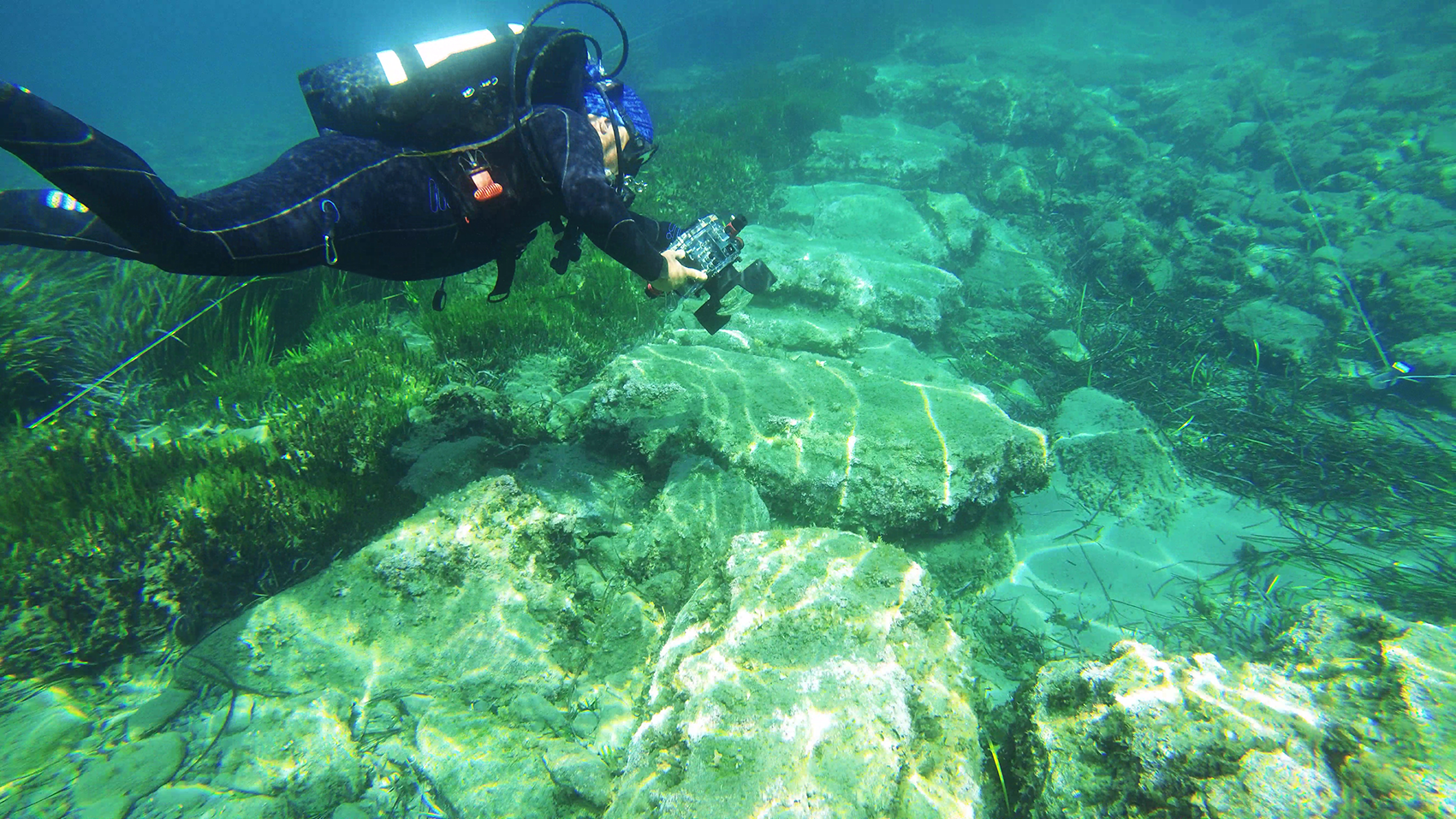
As a first step for the implementation of the project, it was deemed necessary to remove a small section of the marine flora from the harbour moles and their immediate surroundings in order to reveal the preserved architectural remains. A top priority of the project was to ensure the least possible disturbance to the marine environment, and particular care was given to Posidonia oceanica, a protected species of seagrass. Only a very small section of the large Posidonia field of the harbour basin was removed, after a special permission granted by the authorities (the Department of Fisheries and Marine Research, and the Scientific Committee of the Department of Environment, Ministry of Agriculture, Rural Development and Environment). With the valuable contribution of the Marine and Environmental Research Lab, the leaves of the Posidonia were trimmed while the root system was only minimally affected. This work facilitated the aerial and underwater photogrammetric documentation of the ancient harbour structures, for the first time, so that their state of preservation could be thoroughly assessed. The documentation was carried out by the Photogrammetric Vision Lab of the Cyprus University of Technology.
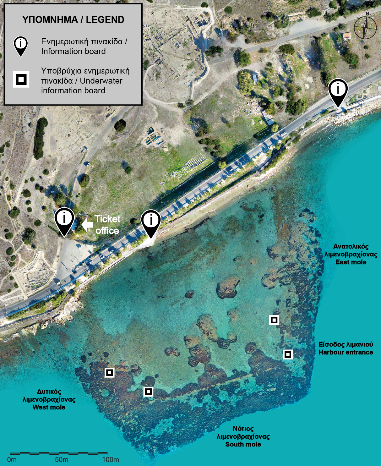
Acknowledging that the cultural and natural heritage constitute an integral part of the unique underwater landscape of Amathus, the permanent intrusions made by the ANDIKAT project were minimal, and serve as an open invitation to different public groups to visit the ancient harbour and its surroundings. Three information boards, one at the entrance of the Amathus archaeological site and two along the coastal walkway, provide information for pedestrians, while four underwater information boards act as orientation points for swimmers.
|
 |
|
|
Since this is an open-access site, emphasis was given to personalised visits. Toward that end, the application 'Amathus Harbour' was created for smart mobile devices, to provide visitors with further information regarding the area in both greek and english.
Remote navigation is possible through an interactive map that provides information complemented with audiovisual media. While on site, the application shows the geographical location of the visitor, indicating the points of interest that are nearby. Users can also enhance the experience of their visit by activating the audio guided tour that will help them discover the most important remains. Walking along the constantly changing coast and listening to or reading about the history and the environment of this unique landscape, visitors may create their own trails, before they swim to have a closer look at the remains of the ancient harbour of Amathus.
In this way, for the first time the public will be offered the opportunity to visit a submerged ancient monument, experience its unique ecosystem and comprehend its multiple significance.
|
   |
|
     |
||
|
Press
|
||